Health & Fitness
Best Hidden Gem of a Park: Lilydale Regional Park
This article was taken from the Spring issue of the Lilydale Newsletter where I write a quarterly column called the Lilydale Explorer.


Lilydale Explorer by Lois Owen, Resident of Lilydale - Best Hidden Gem of a Park: Lilydale Regional Park.
One day last Fall I set as my goal to walk from our Lexington Riverside Condo all the way to St. Paul via the High Bridge. The fall foliage was at its peak and it was a beautiful sky blue day. I figured I’d be safe from traffic, even though there’s no sidewalk, if I stayed to the far left as I went north past 35E and the River Bluff stores.
As I approached Annapolis Street and the start of Cherokee Park, I saw some movement off to my left through the cyclone fence. I wondered what was there and then as I peered through the fence saw people walking on a trail. But I stayed focused and finished my walk to St. Paul where my friend later picked me up so I wouldn’t have to walk all the way back to Lilydale. I told him about the ―secret path I had discovered and told him we’d have to go back there for sure before winter came.
Find out what's happening in Mendota Heightswith free, real-time updates from Patch.
We did make it back a few weeks later but it was a late October evening and as we went down the steep trail it started to get windy, cold and nearly dark, so we headed back up. But we saw and read enough from the interpretive signs put there by St. Paul Parks and Rec. Dept. that told us this was called the Lilydale Regional Park Brickyard Trail, 0.9 mile in length, and approx. 300 vertical feet down, to the area where Lilydale began some 115 years ago. The interpretive signs even showed us a photo of the original ―Lilydale Village Hall – a lot different from the Lilydale City Hall where I work today. And so I learned that Lilydale Regional Park was once the small village of Lilydale and home to a brickyard. I told myself I’d come back here in the spring to explore the area further.
So in early April I came back to the spot where the trail starts, right at Annapolis St. and Cherokee Rd., and set forth with hiking boots on and walking stick in hand and my new zoom lens camera. I was excited to explore and I was lucky to have such a bright sunny day. First I saw dramatic views of the Mississippi River from Vento’s View overlook and the sign explained that the Brickyard Trail was formerly used by the Twin Cities Brick Co. from 1894 to the 1970’s to transport bricks that were manufactured at this site from 90 ft. deep deposits of Decorah shale out of the bluffs. These buff-colored bricks were used in many buildings in the Twin Cities including Metropolitan State U. and the U. of MN campuses.
Find out what's happening in Mendota Heightswith free, real-time updates from Patch.
The trail also leads to fossil beds that contain fossils that were deposited there eons ago when Lilydale was underneath 150 ft. of salt water. On the way down I came to the path that goes to the fossil beds but skipped that because you need to have a special permit to hunt for fossils, so I stayed on the main trail and soon came to a beautiful small waterfall and proceeded on down to Echo Cave, which the sign explained was mined for sand to make bricks.
Then I walked out onto a beautiful grassy open area with a peaceful lake with lots of red-twigged dogwood and even pussy willows. I was thankful all the snow had melted in the open areas. I read the sign which explained that this was Pickerel Lake, named for the northern pike fish that continue to survive in this floodplain lake, because every spring the Mississippi invariably overflows into the lake thereby restocking Pickerel Lake with fish.
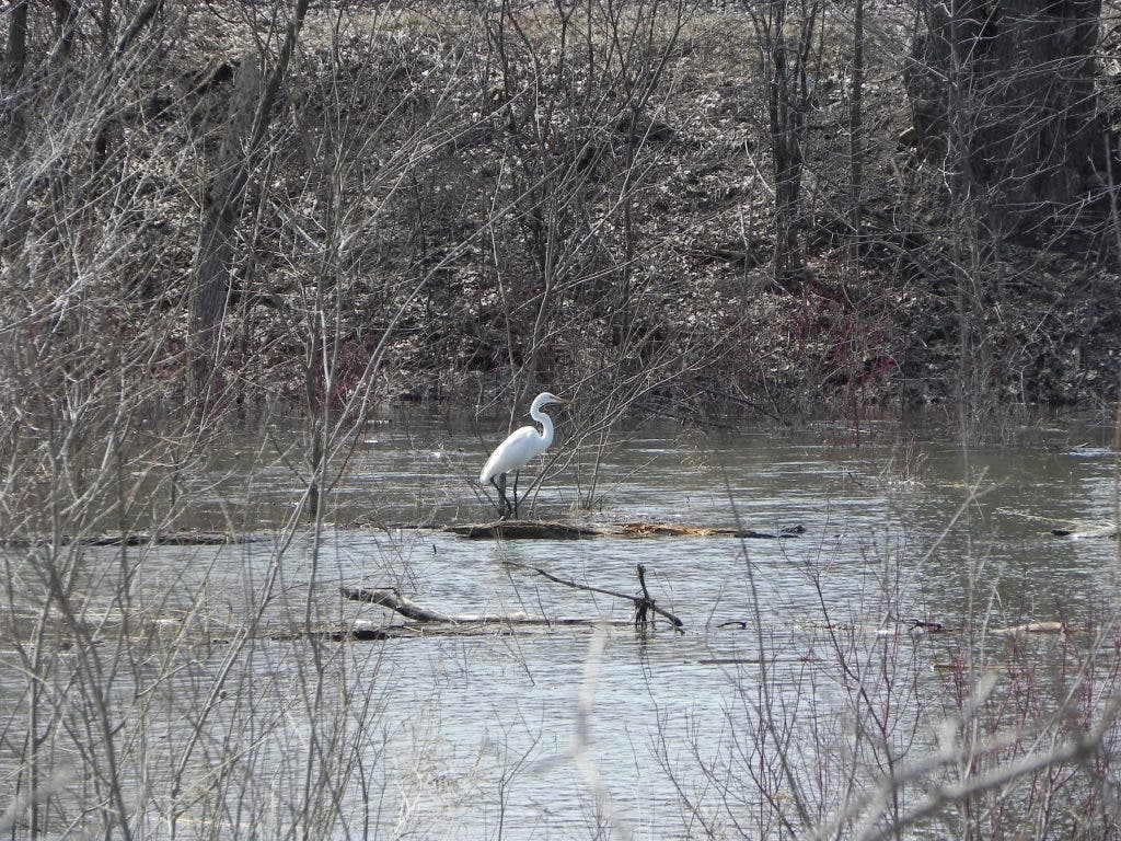
The open grassy area was where the brickyards originally lay. The Brick Co. used Pickerel Lake as a dump for bricks that were unusable. This went on until the Fifties when state and local environmental groups outlawed this practice. Many of the bricks have been removed and the large grassy area now is home to a butterfly garden, which, of course, at this time of year I couldn’t see. I did see lots of ducks, geese, and an egret and a blue heron. I kept walking west, along the edge of the lake and got closer to the old railroad bridge. I was thrilled that I could also see the St. Paul Cathedral and also the Capitol from the lake shore.
I decided to keep trying to go west and sure enough there was a small trail that hadn’t been flooded and I came upon an old railroad bed parallel to the new railroad tracks. I got up on the tracks and kept walking west. I got some good photos and views of the old Schmidt-Landmark Brewery. The lake was still on my right but I was approaching the end of it and then saw a trail go off to the north from the railroad track. I decided to take it as I could see it went fairly close to the western end of the lake and I’d then be able to see the River as well. After scrambling over fallen logs and branches, I came to a dead tree by the lake and all of a sudden a huge eagle flew out above my head and out over the lake.
I kept walking on towards the River even though by now I was no longer on the path, but it didn’t matter because it was impossible to get lost with good bearings of lake, river and railroad tracks. I stayed quiet and peeked through openings in the trees to see a family of muskrats playing with each other in a swampy area of the River in the warm sunshine. One would knock the other off the log into the water and he’d scramble back up. I can now see why they are called musk ―rat because they look like a huge rat, especially when wet.
I was now approaching the Lilydale Yacht Club which was badly flooded, and there was no sign of Lilydale Road anywhere. I climbed down from the tracks and then came upon a whole patch of blooming skunk cabbage. Being a native of the Oregon Coast, I remember seeing these in the damp areas of the woods and knew they were among the first things to bloom in the spring. That was definitely the case here as I hadn’t seen anything else blooming except the pussy willows.
I was excited about all that I had seen on my hiking adventure and now understood a lot more about this beautiful hidden gem of a park and why St. Paul Parks and Recreation, along with the Friends of Lilydale Park, have created a Master Plan to develop it while preserving its wildness and natural beauty.
The plans for the Park may be viewed by visiting www.stpaul.gov and searching ―Lilydale. The immediate plans, which are well underway to completion in the coming one to two years, involve moving Lilydale Road more toward the middle of the Park, putting in a new bridge over the wetlands, and re-aligning parking. This will create not only better views, but a grassy prairie clearing for shelters by the lake. The original historic stone bridge will be incorporated into the bike and pedestrian trail along the river. There will be a gateway monument sign at the entrance of the park near Harriet Island.
All of the structures have been designed with flooding in mind and will be in keeping with both the human history and natural feel of the park. The other parts of the Master Plan have yet to be funded but will include a dog park, more shelters, riverbank restoration, and trail realignment closer to the River, a fishing pier and viewing platforms. It will be exciting in the coming years to see the development of this 384-acre property and its enhancement of the beauty and naturalness of the Mississippi River. This development will support the goals of the Mississippi National River and Recreation Area of which it is an important part.
