Community Corner
Snow Heading Our Way
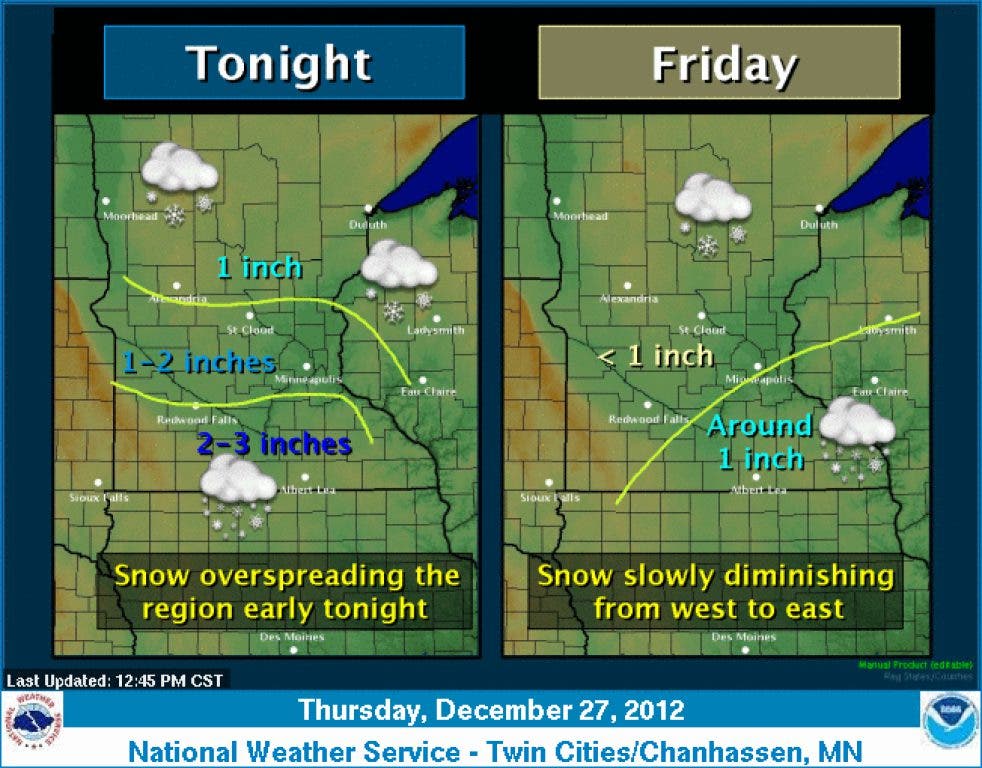
The National Weather Service says areas of Dakota County could receive one or two inches of snow tonight, then about an inch more on Friday.
Follow Mendota Heights Patch on Twitter | Like us on Facebook | Sign up for our free newsletter
Dakota County is in store for a couple of inches of snow.
The National Weather Service has issued a hazardous weather outlook for the Twin Cities metro area beginning this afternoon.
Find out what's happening in Mendota Heightswith free, real-time updates from Patch.
The forecast says Dakota County could receive one to two inches of snow tonight, mainly after 9 o’clock. Less than an inch is possible on Friday.
Here is the text of the outlook:
Find out what's happening in Mendota Heightswith free, real-time updates from Patch.
.DAY ONE...THIS AFTERNOON AND TONIGHT
LIGHT SNOW WILL MOVE INTO SOUTHWEST AND WEST CENTRAL MINNESOTA THIS AFTERNOON...THEN SPREAD NORTHEAST INTO EASTERN MINNESOTA AND WEST CENTRAL WISCONSIN TONIGHT. SNOWFALL AMOUNTS OF UP TO 2 INCHES CAN BE EXPECTED THROUGH TONIGHT...WITH THE HIGHER AMOUNTS ALONG AND SOUTH OF THE INTERSTATE 94 CORRIDOR..DAYS TWO THROUGH SEVEN...FRIDAY THROUGH WEDNESDAY
LIGHT SNOW WILL CONTINUE INTO FRIDAY...DIMINISHING FROM WEST TO EAST ACROSS THE AREA. AN ADDITIONAL 1 TO 2 INCHES OF SNOW CAN BE EXPECTED.
Just to our south, in Rice and Goodhue counties, the service service has issued a winter weather advisory for up to five inches of snow overnight tonight and Friday.
The Rochester area could receive up to six inches of snow by Friday night.
Click here for an updated forecast for Dakota County.